


Table of Contents
- Planning Your Yellowstone Hiking Trip
- Easy & Family-Friendly Yellowstone Hikes
- Fairy Falls Trail
- Storm Point Loop
- Trout Lake Trail
- Geyser Hill Loop
- Artist Paint Pots Trail
- West Thumb Geyser Basin Trail
- Pelican Creek Nature Trail
- Boiling River Trail
- Mammoth Hot Springs Terrace Walks
- Moderate & Scenic Yellowstone Trails
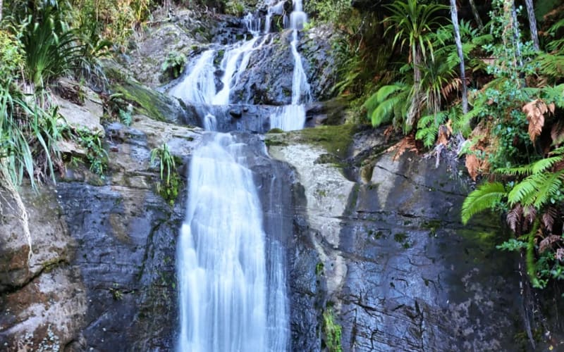
- Mystic Falls Trail
- Lost Lake Loop
- Lone Star Geyser Trail
- Beaver Ponds Trail
- Elephant Back Trail
- Cascade Lake Trail
- Uncle Tom’s Trail / Lower Falls
- Point Sublime Trail (Grand Canyon of the Yellowstone)
- Mount Washburn (via Chittenden Road)
- Challenging & Adventurous Yellowstone Trails
- Avalanche Peak Trail
- Specimen Ridge Trail
- Electric Peak
- Sky Rim Trail
- Union Falls Trail
- Pebble Creek Trail
- Hellroaring Creek Trail
- Seven Mile Hole Trail
- Bunsen Peak Trail
- Top 5 & Most Beautiful Hikes in Yellowstone
- What to Wear Hiking in Yellowstone
- FAQ About Yellowstone Hikes
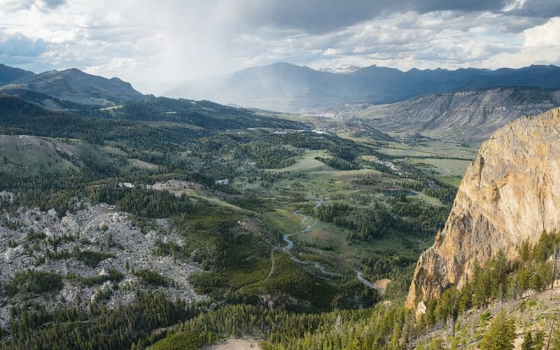
There are hikes in Yellowstone — more than a thousand miles of them. Some are easy lake loops, others climb steep ridges with views that make you forget the effort. Whether you’re a casual walker or a seasoned trekker, there’s a trail here for you.
And while most guides will tell you where to go, few talk about how to go — what it’s like to tackle the terrain, what to watch out for (yes, bears are real), and how to stay warm, dry, and comfortable without looking like you just raided a gear warehouse.
That’s what this guide is for. Think of it as an honest companion for planning your Yellowstone hikes — complete with trail recommendations, safety insights, and practical style advice.
Related Reading:
- Best hikes in San Diego
- Best hikes in Oregon
- Best hikes in LA
- Best hikes in Arizona
- Hiking trails in Austin
- Best hikes in Michigan
Planning Your Yellowstone Hiking Trip
Yellowstone is vast and unpredictable — that’s part of its charm. Before you hit the trails, a little planning goes a long way.
When to Go
The best hiking season runs from late May to early October. Trails are open, the weather’s steady, and wildlife is everywhere. Fall is ideal — crisp air, golden trees, and fewer crowds. Just note that bears are most active in spring and fall , especially early morning and evening.
Weather & Prep
Conditions can swing fast — freezing mornings, warm afternoons, sudden storms. Dress in layers, pack a map and bear spray, and never count on cell service.
Where to Stay
West Yellowstone is the easiest hub for first-timers; Canyon Village puts you close to the park’s famous waterfalls.
Bring smart, comfortable gear — pieces that move with you and handle the elements. Out here, good preparation and the right layers make all the difference.
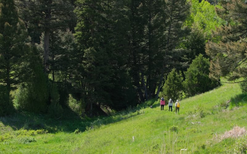
Easy & Family-Friendly Yellowstone Hikes
If you’re new to Yellowstone or just want a relaxed day outdoors, these easy trails are the perfect start. They’re short, scenic, and safe for most ages — ideal for families, beginners, or anyone who prefers a slower pace with big rewards.
Fairy Falls Trail
Easy • 5.4 mi round trip • ~2 hr
- Location: Yellowstone National Park, WY 82190
- Google Maps Link: https://maps.app.goo.gl/t5cxBj4LswVmdywAA
- Rating: 4.7/5
A Yellowstone classic that delivers maximum beauty for minimal effort. Starting near Midway Geyser Basin, the path winds through quiet pine forest and opens to a striking view of the Grand Prismatic Spring from above. Continue another mile to reach the 200-foot Fairy Falls — cool mist, soft light, and the sound of water filling the valley.
Tips: Parking fills quickly; arrive before 9 a.m. or later in the afternoon. Bring water and sunscreen — shade is limited.
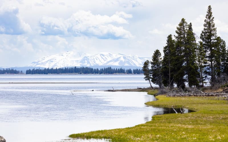
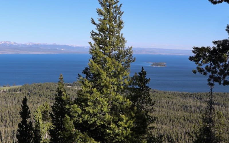
Storm Point Loop
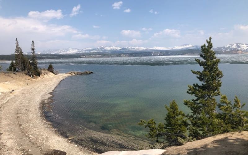
Easy • 2.3 mi • ~1 hr
- Location: Wyoming 82414
- Google Maps Link: https://maps.app.goo.gl/fMKwGkKHQ8Pu41nh9
- Rating: 4.7/5
A peaceful walk along Yellowstone Lake with open meadows, pine forest, and wide-angle views. The breeze carries the scent of pine and cold water, changing with the weather.
Tips: Best walked clockwise for lake views. Avoid stormy days — the exposed shoreline can get slick and windy.
Trout Lake Trail
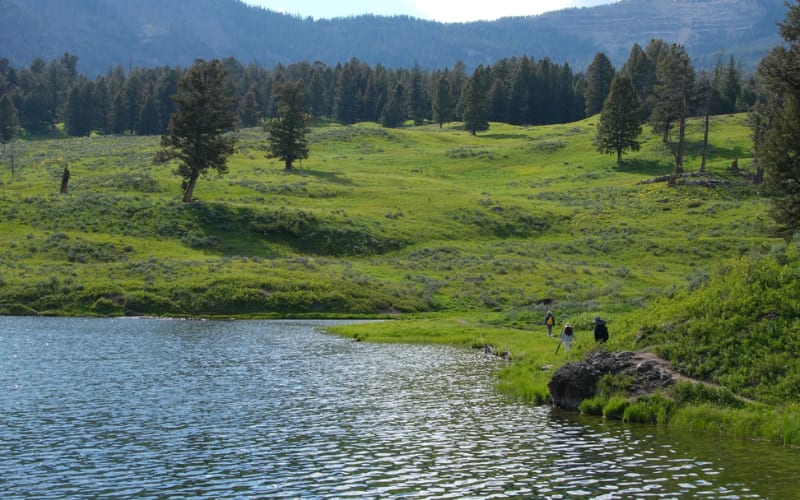
Easy • 1.2 mi round trip • ~40 min
- Location: Wyoming 82190
- Google Maps Link: https://maps.app.goo.gl/EgcXts5JFWaAWiux7
- Rating: 4.9/5
Short but surprisingly remote. A brief uphill through forest leads to a mirror-still alpine lake surrounded by fir trees. Quiet, calm, and often visited by otters or trout at dawn.
Tips: The first slope can be slippery after rain. Parking is limited; carry bear spray and keep distance from wildlife.
Geyser Hill Loop
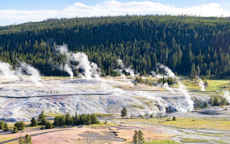
Easy • 1.3 mi • ~40 min
- Location: Yellowstone National Park, WY 82190
- Google Maps Link: https://maps.app.goo.gl/hV1VNk1kS4Ze5D1YA
- Rating: 4.6/5
Right behind Old Faithful , this boardwalk loop circles a basin alive with steam, bubbling mud, and hissing vents. It’s Yellowstone in a nutshell — raw, colorful, and constantly shifting.
Tips: Stay on the boardwalk at all times. Go early or late for cooler air and softer light.
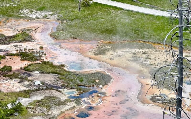
Artist Paint Pots Trail
Easy • 1 mi • ~30 min
- Location: Wyoming 82190
- Google Maps Link: https://maps.app.goo.gl/L3aqXGbJafivR4y68
- Rating: 4.7/5
A quick, colorful loop showcasing Yellowstone’s geothermal art. The hillside glows in blues, oranges, and reds, and the bubbling mud pots never fail to impress.
Tips: Best visited in the morning for photos. Keep a safe distance from thermal features; surfaces can be unstable.
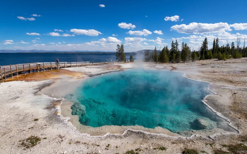
West Thumb Geyser Basin Trail
Easy • 0.8 mi • ~30 min
- Location: Yellowstone National Park, WY 82190
- Google Maps Link: https://maps.app.goo.gl/enPgvrXiqzjkoeKcA
- Rating: 4.8/5
Where geysers meet the water’s edge. This boardwalk circles Yellowstone Lake , with steam rising beside deep blue pools — a surreal mix of calm and energy.
Tips: Access from the West Thumb lot near Grant Village. Visit early for peace and reflection.
Pelican Creek Nature Trail
Easy • 1 mi • ~30 min
- Location: Wyoming 82414
- Google Maps Link: https://maps.app.goo.gl/7jVMu7i6xRuZk4vt8
- Rating: 4.5/5
A quiet walk near Yellowstone Lake, great for spotting wildlife like bison, elk, and pelicans. It’s especially peaceful at sunrise or sunset.
Tips: Can be muddy in spring; use waterproof shoes and insect repellent. Always keep distance from animals.
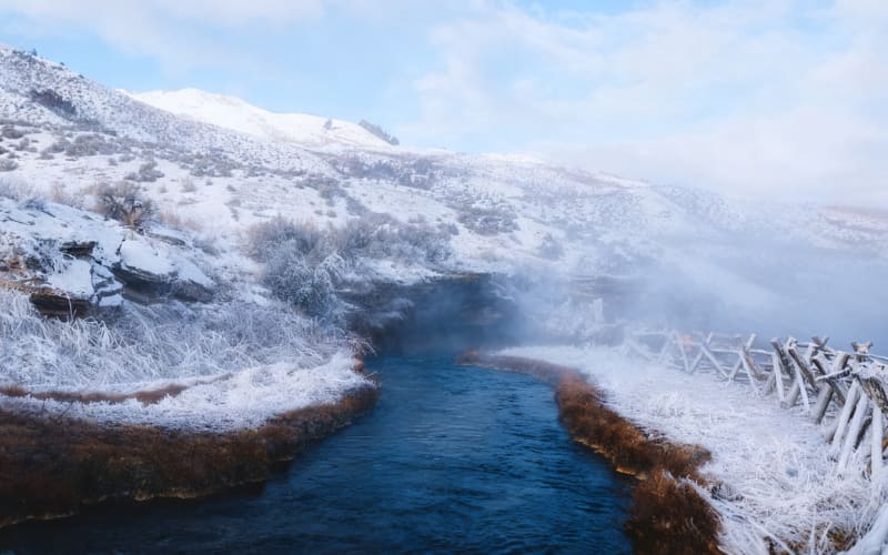
Boiling River Trail
Easy • 1.5 mi round trip • ~45 min (Seasonal)
- Location: Wyoming 82190
- Google Maps Link: https://maps.app.goo.gl/HmKJHEYEnGT5w1Vt5
- Rating: 4.1/5
A rare Yellowstone experience — a short walk ending at a natural hot-spring soak where thermal water meets the cold Gardner River.
Tips: Bring water shoes and check conditions before visiting; closures happen during high water or cold snaps.
Mammoth Hot Springs Terrace Walks
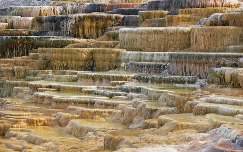
Easy • Variable • 30–60 min
- Location: Mammoth, WY 82190
- Google Maps Link: https://maps.app.goo.gl/fxMvrrtLZaaELsaG6
- Rating: 4.7/5
Wooden boardwalks wind through steaming limestone terraces tinted white, orange, and gold. Highlights include Minerva Terrace and Canary Spring , both spectacular in afternoon light.
Tips: Surfaces can be slick — wear shoes with grip. Start from the Upper or Lower Terrace lots; both loops connect.
Moderate & Scenic Yellowstone Trails
If you’re after a bit more challenge without turning it into an expedition, these trails strike the perfect balance. Each one rewards steady effort with sweeping views, quiet forests, and classic Yellowstone drama — geysers, waterfalls, meadows, and canyons all in the mix.
Mystic Falls Trail
Moderate • 3.5 mi round trip • ~2 hr
- Location: Yellowstone National Park, WY 82190
- Google Maps Link: https://maps.app.goo.gl/23vbbev3MW3frm6i6
- Rating: 4.8/5
A perfect mid-distance hike showcasing everything Yellowstone is known for. Starting at Biscuit Basin, it winds through forest and meadow to Mystic Falls , a 70-foot cascade tucked in a canyon. Continue up the switchbacks for a panoramic view over the Upper Geyser Basin — you might even spot Old Faithful erupting in the distance.
Tips: The upper section can be slick after rain; wear good shoes and bring water.
Lost Lake Loop
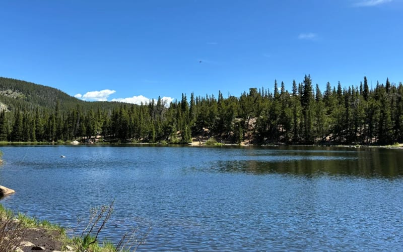
Moderate • 4 mi • ~2.5 hr
- Location: Wyoming 82190
- Google Maps Link: https://maps.app.goo.gl/6tzntGFDZpp254PB9
- Rating: 5.0/5
A timeless Yellowstone loop through meadows, pine forest, and along the quiet shores of Lost Lake . Wildlife sightings — elk, marmots, even black bears — are common in early morning.
Tips: Use insect repellent in summer; mosquitoes can be thick near the lake.
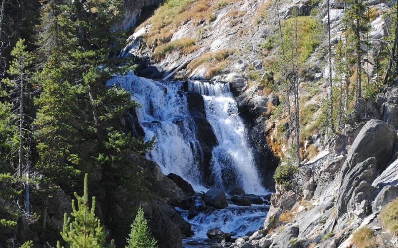
Lone Star Geyser Trail
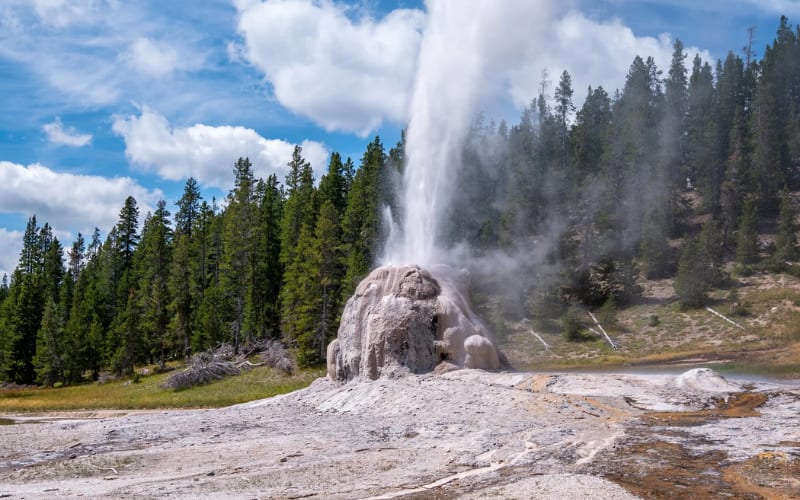
Moderate • 5 mi round trip • ~2 hr
- Location: Wyoming 82190
- Google Maps Link: https://maps.app.goo.gl/awqVmdqMLRQnsorh7
- Rating: 4.9/5
One of Yellowstone’s most peaceful geyser hikes. Following the Firehole River, the wide trail leads to Lone Star Geyser , which erupts about every 90 minutes, sending water nearly 40 feet high.
Tips: Check eruption times on-site and arrive 15–20 minutes early. Closed during spring thaw.
Beaver Ponds Trail
Moderate • 5 mi loop • ~2.5 hr
- Location: Yellowstone National Park, WY 82190
- Google Maps Link: https://maps.app.goo.gl/iWes1MhJTauqAaH76
- Rating: 4.8/5
A varied loop near Mammoth Hot Springs with open hills, forest shade, and quiet ponds alive with wildlife — elk, beavers, and sometimes black bears.
Tips: Carry bear spray and make noise in wooded areas where visibility is low.
Elephant Back Trail
Moderate • 3.5 mi round trip • ~1.5 hr
- Location: Yellowstone National Park, Upper Terrace Loop Dr, Mammoth, WY 82190
- Google Maps Link: https://maps.app.goo.gl/SF6djbjm5ojjRqdY6
- Rating: 3.8/5
A short, steady climb through shaded forest to one of the best overlooks of Yellowstone Lake . The ridge curves like an elephant’s back, offering broad blue views at the top.
Tips: No shade at the overlook — bring water. Early or late hikes offer the best light.
Cascade Lake Trail
Moderate • 4.5 mi round trip • ~2 hr
- Location: Wyoming 82190
- Google Maps Link: https://maps.app.goo.gl/kuTkPcQ69dQLcjW18
- Rating: 5.0/5
A gentle route through wildflower meadows that bloom in brilliant color by midsummer. Ends at calm Cascade Lake , perfect for a picnic and quiet reflection.
Tips: Afternoon thunderstorms are common — pack a light rain layer.
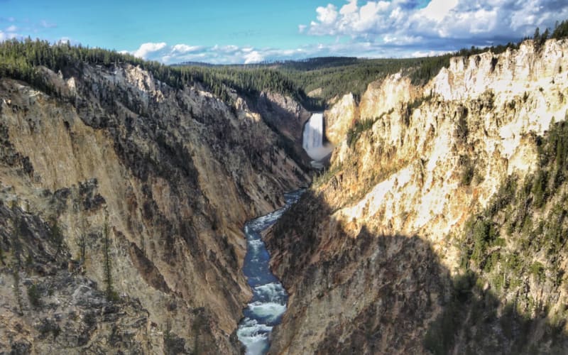
Uncle Tom’s Trail / Lower Falls

Moderate • 0.7 mi round trip • ~30–45 min
- Location: Wyoming 82190
- Google Maps Link: https://maps.app.goo.gl/6jEPAdtMWZkGregY9
- Rating: 4.8/5
Short, steep, and unforgettable. Descend 300 steel steps down the Grand Canyon of the Yellowstone to a platform near the 308-foot Lower Falls. The spray and roar are unforgettable; the climb back up is a workout but worth it.
Tips: Check for closures before visiting. Steps can be slippery; wear solid shoes.
Point Sublime Trail (Grand Canyon of the Yellowstone)
Moderate • 3 mi round trip • ~1.5 hr
- Location: Wyoming 82190
- Google Maps Link: https://maps.app.goo.gl/3hpooxhvNpZpTfYw9
- Rating: 5.0/5
Starting near Artist Point, this rim trail leads through forest to one of the canyon’s most dramatic lookouts — Point Sublime . The golden cliffs and whitewater below are unforgettable.
Tips: Stay behind railings; cliffs are fragile. Late afternoon light is stunning for photos.
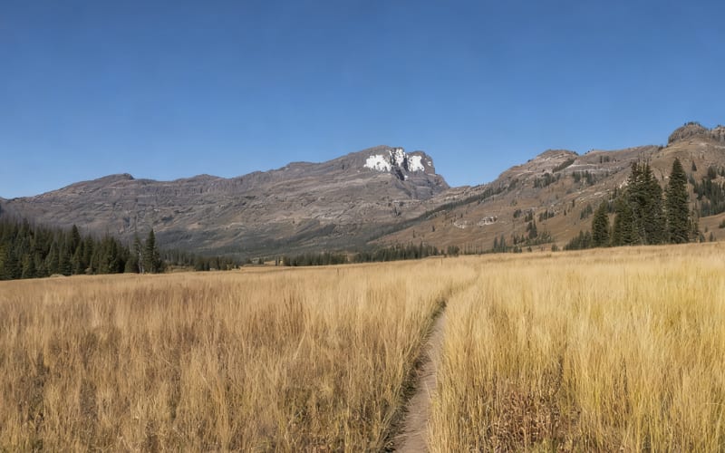
Mount Washburn (via Chittenden Road)
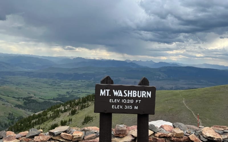
Moderate–Strenuous • 6.4 mi round trip • ~3–4 hr
- Location: Yellowstone National Park, WY 82190
- Google Maps Link: https://maps.app.goo.gl/4h63FhLJj96mBxsE7
- Rating: 4.9/5
An iconic Yellowstone summit hike — steady, scenic, and satisfying. The trail climbs from the parking area up an old road to the Mount Washburn Fire Lookout , passing wildflowers and marmots along the way. At the top, 50-mile views stretch across the Absaroka Range.
Tips: Bring layers — it’s cold and windy even in midsummer. Start early to avoid afternoon storms.
Challenging & Adventurous Yellowstone Trails
These are the hikes that earn every view. Longer, steeper, and quieter — perfect for experienced hikers or anyone craving solitude above the treeline. Expect big climbs, thin air, and landscapes that make you feel wonderfully small.
Avalanche Peak Trail
Challenging • 4.5 mi round trip • 2,100 ft gain • ~3 hr
- Location: Wyoming 82190
- Google Maps Link: https://maps.app.goo.gl/kDsVAPFDjpynqJdu8
- Rating: 5.0/5
A steep alpine climb with one of Yellowstone’s best summit panoramas. Starting near Eleanor Lake, the trail rises quickly through forest before breaking into open tundra with sweeping views of the Absaroka Range. Snow can linger until July and storms move fast.
Tips: Start early and bring layers — lightning is common in afternoons. Trailhead is 19 mi east of Fishing Bridge.
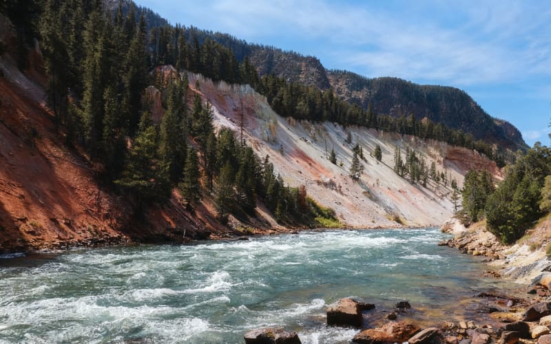
Specimen Ridge Trail
Challenging • 17 mi point-to-point • ~8–10 hr
- Location: Wyoming 82190
- Google Maps Link: https://maps.app.goo.gl/FCpDgLJbzT1jWBqZ8
- Rating: 4.7/5
A demanding, unforgettable trek across open country above Lamar Valley and the Yellowstone River. Expect fossilized trees, windswept ridges, and grazing bison. It’s long and exposed — endurance more than technique.
Tips: Set up a shuttle; it’s point-to-point. Carry plenty of water — no reliable sources.
Electric Peak
Very Challenging • 10.6 mi one way • ~9–10 hr
- Location: Montana 59030
- Google Maps Link: https://maps.app.goo.gl/ehoDW6RvHMvD6AoSA
- Rating: 4.8/5
Yellowstone’s highest northern summit and a true test of stamina. The trail climbs steadily from Mammoth through forest and meadows to rocky alpine slopes. The final mile is a scramble to the 10,969-ft peak with vast Gallatin Range views.
Tips: Start before sunrise to avoid storms. Expect wind and temperature drops near the top.
Sky Rim Trail
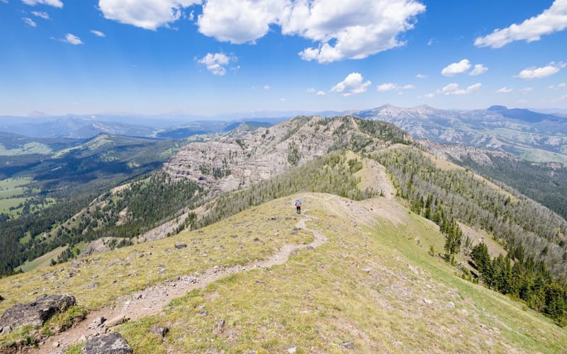
Advanced • 20.5-mi loop • ~10–12 hr or overnight
- Location: Montana 59758
- Google Maps Link: https://maps.app.goo.gl/icKuREVfU7krorMN9
- Rating: 4.8/5
A high-elevation ridge walk above 9,000 ft, offering nonstop views of the Gallatin Range. Remote, windy, and unforgettable. Attempt in a day only if highly fit; otherwise, camp along the route.
Tips: Cross exposed ridges early to avoid lightning. Few water sources — pack extra.
Union Falls Trail
Challenging • 16 mi round trip • ~8 hr
- Location: Wyoming 82190
- Google Maps Link: https://maps.app.goo.gl/dG7Gdpx8vg3696ir8
- Rating: 5.0/5
A long, rewarding hike to one of Yellowstone’s most beautiful waterfalls. Forest, meadows, and stream crossings lead to the 250-ft fan-shaped Union Falls in the park’s southwest.
Tips: Bring water shoes and repellent. Best from mid-July to September when creeks are lower.
Pebble Creek Trail
Challenging • 12 mi point-to-point • ~6–8 hr
- Location: Yellowstone National Park, WY 82190
- Google Maps Link: https://maps.app.goo.gl/ZpmwrDaFm4aTuiX29
- Rating: 4.7/5
A remote backcountry route through Lamar Valley’s heart, with cliffs, canyons, and wide meadows. Wildlife sightings — elk, bighorn sheep, even bears — are common.
Tips: Hike with a shuttle setup. Carry bear spray and watch weather; storms move fast.
Hellroaring Creek Trail

Challenging • 7 mi round trip • ~3 hr
- Location: Yellowstone National Park, WY 82190
- Google Maps Link: https://maps.app.goo.gl/BXNTXpP4aUrZnxUc7
- Rating: 5.0/5
A short but steep route featuring a dramatic Yellowstone River suspension bridge before climbing to Hellroaring Creek. The return is a steady uphill push.
Tips: Use trekking poles for the climb. Great early-season option when higher trails hold snow.
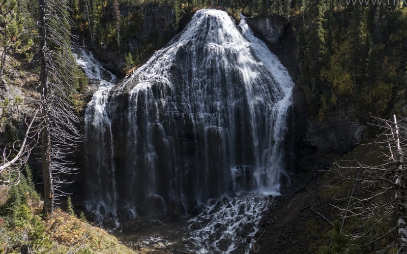
Seven Mile Hole Trail
Challenging • 10 mi round trip • ~5–6 hr
- Location: Yellowstone National Park, WY 82190
- Google Maps Link: https://maps.app.goo.gl/hZbvrGm321EzAyHP8
- Rating: 4.7/5
One of the few trails descending deep into the Grand Canyon of the Yellowstone. It drops nearly 1,000 ft to the river, passing steam vents and golden canyon walls. The climb out is steep but spectacular.
Tips: Avoid midday heat; the canyon amplifies sun and temperature. Bring extra water.
Bunsen Peak Trail
Challenging • 4.4 mi round trip • ~2 hr
- Location: Wyoming 82190
- Google Maps Link: https://maps.app.goo.gl/QGgzMEHQpB85cnM98
- Rating: 4.9/5
A quick, steep ascent of a volcanic cone overlooking Mammoth and the northern range. Gains 1,300 ft in two miles, with sweeping 360° views at the summit.
Tips: Start early to beat heat and crowds. It’s windy on top — hold onto your hat.
Top 5 & Most Beautiful Hikes in Yellowstone
Some trails capture the full spirit of Yellowstone — its waterfalls, forests, geysers, and wide-open views. The five hikes below are among the park’s most beautiful.
|
Trail |
Distance |
Highlights |
Why It’s Special |
|
Fairy Falls Trail |
5.4 mi round trip | Forest walk, Grand Prismatic Spring view, 200-ft waterfall | One of Yellowstone’s most photogenic spots — easy terrain, huge reward. |
|
Mystic Falls Trail |
3.5 mi round trip | Forest, geysers, 70-ft waterfall | Combines classic geyser-basin scenery with a short climb to a stunning overlook. |
|
Uncle Tom’s Trail / Lower Falls |
0.7 mi round trip | Canyon staircase, roaring waterfall | Short but steep; the Lower Falls viewpoint delivers pure Yellowstone drama. |
|
Mount Washburn |
6.4 mi round trip | Alpine climb, wildflowers, summit lookout | Panoramic 360° views across the park; one of Yellowstone’s iconic summits. |
|
Storm Point Loop |
2.3 mi loop | Yellowstone Lake shore, forest meadow mix | Gentle, peaceful, and perfectly scenic — best for relaxed hikers or families. |
Best Time to Visit & Seasonal Outfit Checklist
|
Season |
Trail Highlights |
Weather |
Outfit Tip |
| Spring | Lower Geyser Basin | Wet & muddy | Waterproof jacket + breathable layer |
| Fall | Lost Lake, Storm Point | Crisp, golden forest | Wool sweater + softshell |
| Winter | Mammoth Hot Springs | Icy, quiet | Down parka + gloves + boots |
What to Wear Hiking in Yellowstone
Layering Is Everything
Weather in Yellowstone has a mind of its own — a clear morning can turn windy, wet, or even snowy by afternoon. That’s why smart hikers always dress in layers .
Think of it this way:
-
Base Layer: Keeps you dry and regulates temperature. Merino wool or moisture-wicking synthetics are ideal.
-
Mid Layer: Adds warmth and flexibility — a vest or fleece is perfect.
-
Outer Layer: Protects against wind, rain, and sudden drops in temperature. Choose something waterproof yet breathable.
With this system, you can easily adjust your comfort level as conditions change throughout the day.
What to Wear by Season
Fall (September–October)
Crisp air, golden light, and temperatures that shift quickly from morning chill to afternoon sun.
Start with a soft base layer and add the Alpargali Graphene Vest , which combines graphene heat-lock technology with Teflon™ water resistance and Sorona® eco insulation. It’s thin, light, and warm — ideal for layering under a shell.
For wind and occasional drizzle, the Alpargali Graphene Lightweight Jacket adds breathable protection and a clean, minimal style that works from trail to town.

Winter (November–March)
Yellowstone in winter is breathtaking — and brutally cold. You need serious insulation that doesn’t feel heavy.
The Alpargali Aerogel Graphene Puffer Jacket merges NASA-inspired aerogel with graphene and Sorona® insulation to deliver extreme warmth without bulk. With its Teflon™ waterproof shell and four-layer thermal system, it keeps you comfortable from –40°C to +10°C . It’s breathable, windproof, snow-resistant, and designed for both exploration and daily wear.

Spring & Summer (April–August)
Even in July, mornings can be cool and windy near geyser basins or lakes. A light, weatherproof outer shell like the Alpargali Men’s All-Weather Outdoor Jacket is ideal — fully waterproof (15K) and breathable (15K), with functional details like hidden pockets and reflective prints.
For milder days or shoulder seasons, the Alpargali CoreShell Jacket offers the perfect balance: windproof, water-resistant, and lined with innovative Core Lock™ fleece that boosts warmth by 30% while staying light and flexible.

Why Choose Alpargali
Every piece in the Alpargali lineup is created with one vision: to blend advanced material technology with thoughtful design for real-world performance . Each garment is engineered with purpose — aerogel and graphene for extreme insulation, Sorona® and Core Lock™ fleece for breathable warmth, and Teflon™ coatings for reliable weather protection.
The result is gear that feels as natural on a trail as it does in the city — a perfect balance of innovation, comfort, and versatility. Whether you’re planning your next trip with this Yellowstone hiking guide or gearing up for weekend adventures closer to home, Alpargali helps you stay ready for every change in terrain and temperature.
FAQ About Yellowstone Hikes
How likely are you to see a grizzly in Yellowstone?
It’s fairly common to spot a grizzly or black bear from a distance in Yellowstone, especially in open areas like Lamar or Hayden Valley. Roughly half of visitors see large wildlife during their trip, though close encounters are rare. Always observe from at least 100 yards away and carry bear spray for safety.
Should you carry a gun while hiking in Yellowstone?
No. Firearms are not a safe or effective way to protect yourself from wildlife. The best precautions are to hike in groups, make noise, and carry bear spray , which has been proven far more reliable in real encounters.
What month are bears most active in Yellowstone?
Bears are most active from April through October, especially in spring and fall when food is scarce and they’re preparing for or emerging from hibernation. They’re most visible in the early morning and late evening hours.
Is hiking better in Yellowstone or Grand Teton?
Both parks are exceptional, but they offer different experiences. Yellowstone is more diverse — geysers, waterfalls, forests, and wildlife — while Grand Teton is steeper and more rugged, ideal for experienced hikers seeking alpine terrain. If you have time, explore both for the full range of landscapes and adventure.


